
-
미리보기
서지정보
· 발행기관 : 명지대학교(서울캠퍼스) 인문과학연구소
· 수록지 정보 : 인문과학연구논총 / 36권 / 4호 / 193 ~ 229페이지
· 저자명 : 김차규
초록
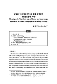
This article focus on d’Anville’s map and many of maps reproduced in the 18th and 19th centuries including his map used by other cartographers. Maps produced in 17th century shows Korea as an island or a simple form peninsula. They showed the appearance distorted of Korea to europeans in the same time. D’Anville’s map of Korea is a landmark in the mapping of Korea and the first map to provide a reasonable accurate mapping of the Peninsula. This was the most accurate map of the Korean kingdom to date, not superadded for almost two hundred years. The map shows Dokdo Islets have been “Part of Korean territory” and border line of Korea perched further north than border line between Korea and China in the present. The d’Anville map is a signal achievement in the mapping of Korea that combines the work of Jesuit cartographers and Chinese surveyors, no doubt using Korean maps as guides, published in Paris and disseminated widely through Europe in many subsequent editions and copies. For the first time, Western audiences had a fairly accurate map of Korea. The map remained the most important and influential mapping of Korea for the next century or more.영어초록
This article focus on d’Anville’s map and many of maps reproduced in the 18th and 19th centuries including his map used by other cartographers. Maps produced in 17th century shows Korea as an island or a simple form peninsula. They showed the appearance distorted of Korea to europeans in the same time. D’Anville’s map of Korea is a landmark in the mapping of Korea and the first map to provide a reasonable accurate mapping of the Peninsula. This was the most accurate map of the Korean kingdom to date, not superadded for almost two hundred years. The map shows Dokdo Islets have been “Part of Korean territory” and border line of Korea perched further north than border line between Korea and China in the present. The d’Anville map is a signal achievement in the mapping of Korea that combines the work of Jesuit cartographers and Chinese surveyors, no doubt using Korean maps as guides, published in Paris and disseminated widely through Europe in many subsequent editions and copies. For the first time, Western audiences had a fairly accurate map of Korea. The map remained the most important and influential mapping of Korea for the next century or more.참고자료
· 없음태그
-
자주묻는질문의 답변을 확인해 주세요

꼭 알아주세요
-
자료의 정보 및 내용의 진실성에 대하여 해피캠퍼스는 보증하지 않으며, 해당 정보 및 게시물 저작권과 기타 법적 책임은 자료 등록자에게 있습니다.
자료 및 게시물 내용의 불법적 이용, 무단 전재∙배포는 금지되어 있습니다.
저작권침해, 명예훼손 등 분쟁 요소 발견 시 고객센터의 저작권침해 신고센터를 이용해 주시기 바랍니다. -
해피캠퍼스는 구매자와 판매자 모두가 만족하는 서비스가 되도록 노력하고 있으며, 아래의 4가지 자료환불 조건을 꼭 확인해주시기 바랍니다.
파일오류 중복자료 저작권 없음 설명과 실제 내용 불일치 파일의 다운로드가 제대로 되지 않거나 파일형식에 맞는 프로그램으로 정상 작동하지 않는 경우 다른 자료와 70% 이상 내용이 일치하는 경우 (중복임을 확인할 수 있는 근거 필요함) 인터넷의 다른 사이트, 연구기관, 학교, 서적 등의 자료를 도용한 경우 자료의 설명과 실제 자료의 내용이 일치하지 않는 경우
“인문과학연구논총”의 다른 논문도 확인해 보세요!
-
‘생명줄(命綱)로서의 일본어’ 결과를 중심으로 살펴본 재해 관련 용어 연구 20 페이지
This paper is intended to analyze the part of the investigation of the ‘Japanese as a lifeline’. ‘Japanese as a lifeline’ is a term card that has been created to actually have smooth communication in .. -
문학번역 텍스트의 전용: 하이재킹(hijacking) -토니 모리슨의 『가장 푸른 눈』을 중심으로 20 페이지
Traditionally, the ideal translation of an original text had been considered to be transposed into a target language as faithfully as possible. However, in recent years, translation has gradually come.. -
계몽주의 페미니스트 오스틴이 바라본 남성인물, 남성중심적 가치 22 페이지
Jane Austen as an Enlightenment Feminist tries to create male characters with both reason and feeling in her novels, which is interpreted as her tactic for showing that men and women are not different..
문서 초안을 생성해주는 EasyAI

