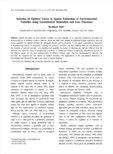
The applicability of the geostatistical framework is demonstrated and discussed through a case study ... In this paper, a geostatistical framework is illustrated that consists of uncertainty modeling via stochastic ... that quantify the impact of choosing any estimate different from the unknown true value are linked to geostatistical
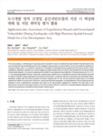
objective way to make data covariance matrix that reflects the state of the achieved field data by geostatistical ... Dipole-dipole DC resistivity data were proposed for a prior information of gravity data and we applied the geostatistical
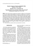
The results were then compared with the method of geostatistical inversion proposed by authors. ... Inversion result of geophysical data given as a block type was geostatistically simulated with borehole ... Downscaling method used in this study showed relatively more flexible than the geostatistical inversion
Of the various geostatistical techniques for the integrated data analysis, in this study, we applied ... 반영하는 암반등급 분포를 만들어내는 것으로 보인다. 3D RMR (Rock Mass Rating) analysis has been performed by applying the Geostatistical
The main objective of this paper is to exemplify how indicator geostatistics can be effectively applied ... It is suggested that the indicator geostatistical framework illustrated in this study be a useful tool ... A whole geostatistical analysis framework, which includes probabilistic uncertainty modeling, classification
The PCA-based method seemed to be effective to restore the periodical signals and the geostatistical ... For the restoration, both of the methods, geostatistical and optimizaed PCA, showed stable result when ... Restoration methods based on an optimized principal component analysis (PCA) and the geostatistical kriging
The effective radius was determined from the errors of radar rainfall using geostatistical method, and ... to estimate the radar precipitation applying to the local gauge correction (LGC) method which uses geostatistical
This study suggests that the integrated geostatistical approaches were used for a decision-making process ... both the results of DC resistivity and MASW surveys at the same location showed that an integrated geostatistical
This paper suggests a conditional simulation framework based on multiple data transformations for geostatistical ... Therefore, it is expected that the presented simulation framework can be effectively applied to geostatistical
먼저 주어진, 관심 있는 공간에서 조사점이 연속적으로 구해질 수 있는 경우, 이때 얻어진 자료를 Geostatistic 자료라고 한다.의 형태이다. ... 차 례 제 1 장 서론 1.1 공간통계분석 1.2 공간통계의 모형 1.3 공간통계자료의 종류 제 2 장 Geostatistic 자료 분석을 위한 탐색적 분석 2.1 제3장 공간통계분석을