본 연구에서는 국내 원전이 위치한 지역의 토양에서 의 축적 경향을 파악하기 위하여 원전이 위치한 영광군 관내의 평지와 고산지대인 금정산, 불갑산 및 영광원전으로부터 원거리에 위치한 내장산 등을 대상으로 토양중 의 화학적인 특성과 고도에 따른 의 축적 경향을 평가하기 위..
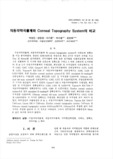
Canon RK -3 7.928 mm, EyeSys corneal topography system 7.879 mm 및 Orbscan corneal topography system 8.016 ... 자동각막곡률계 및 corneal topography system 의 신뢰도와 정확도 틀 비교 분석하였다. ... EyeSye corneal topography system values were 0.301. 0.257 and 0.:n8.
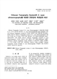
Orbscan Topography System 측정값을 A - scan Ultrasonography 측정값과 직접 비교하기 위해서는 환산공식이 필요하다. ... Orbscan Topography System 및 A - scan Ultrasonography로 전 방깊 이 훌 측정 하 여 두 기 기 의 신 뢰 도를 평 가하고, A - scan ... Ultrasonography률 gold standard로 간주 하여 Orbscan Topography System으로 측정한 전방깊이 값의 정확도를 분석하였다. 20안올 대 상으로
To
characterize the effect of micro-topography, changes in water level and vegetation pattern were monitored ... The purpose of this study is to investigate the effect of micro-topography to vegetation pattern in Dunchon-dong
도로교통안전관리공단의 교통사고 통계에 의하면 최근 2년간(2004~2005년) 노면상태별 교통사고는 건조한 노면상태에서 연평균 183,643건으로 가장 높게 발생하였다. 그러나 사고 100건당 사망자 수인 치사율의 경우 노면상태가 습기인 경우가 3.59로 가장 높으며,..
강화 남부 갯벌의 장기적인 퇴적환경 변화를 파악하기 위하여 1997년과 2011년 여름철 표층 퇴적물의 분포와 1998년 4월과 2013년 3월의 갯벌 고도를 비교하였다. 표층퇴적물은 1997년에 동부의 펄, 서부의 모래 펄 퇴적물이 우세하였으나,2011년에는 동부의 ..
Abstract Purpose : The purpose of this study is to compare corneal curvature, corneal topography, and ... Key words : Corneal topography, Keratometer, Refractive surgery 대한시과학회 대한시과학회지 Young-Mo Kang, In-Chul ... two groups using an autorefractor-keratometer, measured curvature by area of the cornea using corneal topography
In this study, key information including topography, dike height distribution, and future coastal flooding ... Especially, as the 3D precision topography effectively conveys important messages relating to vulnerability
장애아동에게 적용한다면 바른 자세로 앉아있기, 선생님을 똑바로 쳐다보기 등을 지속시간이나 빈도로 측정하는 것보다 Topography로 측정하는 것이 더 의미있는 경우에 Topography로 ... 따라서 부적응행동 뿐만 아니라 모든 행동을 측정하는 여러가지 척도들을 살펴보아야 하기 때문에 Topography를 소개했습니다. 부적강화는 혐오자극을 제거 하는 겁니다. ... -->(반응 조건화) 이때 종소리는 반응조건화가 되기 전에는 NS(중립자극)이지만, 반응조건화가 된 후에는 CS(조건자극)으로 전환되죠 Topography에 의한 측정이란 골프 선수의
Tunnel positioning in the light of topography can reduce the deforested area by up to 1.5ha at each tunnel ... deforested areas at each end of the tunnel by the design of the tunnel entrance and exit and forest topography
Vertical turbulent mixing due to the seabed topography at Ganjeol Point can reinforce the upwelling of ... Variations in the isothermal lines for surface temperature along the coast showed that the seabed topography
First, development have been adapted to the topography. ... topographical conditions such as land cutting area, a retaining wall, land-diving was maintaining the original topography
Tourists like it because it is a garden that utilizes the natural topography of the mountain, which is ... Tourists like it because it is a garden that utilizes the natural topography of the mountain, which is
architectural garden structures and elements fit in well with natural rocks, streams woods, and the topography ... building slightly deviates from each other buildings: all the buildings are arranged according to the topography ... large-scale architecture such as a palace had to be built after due consideration of its harmony witthe topography